Fremont Lake Watershed Modeling
PLOAD L-THIA NPS ISAT
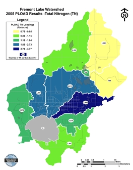
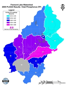
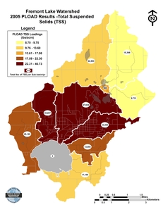
The U.S. EPA's Pollutant Loading Model (PLOAD) calculates pollutant loadings for sub-basins using the different land use and cover periods (1978, 1998, and 2005), hydrologic soil groups, and precipitation. The PLOAD model results demonstrate across the board increases from 1978 to 2005 in total nitrogen, total phosphorus, and total suspended solids for the Fremont Lake Watershed. This increase is a result of the change in land use and cover (increase in urban/built up lands) and could also be due to changes in the amount of precipitation.
Fremont Lake 2005 PLOAD
Total Nitrogen
Fremont Lake 2005 PLOAD
Total Phosphorus
Fremont Lake 2005 PLOAD
Total Suspended Solids
Click Image for Larger Map
TOP
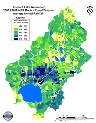
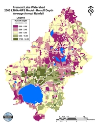
The U.S. EPA's Long-Term Hydrologic Impact Assessment and Nonpoint Source Pollutant (LTHIA-NPS) model was used to evaluate stormwater runoff status in the Fremont Lake Watershed. The model runs for the LTHIA-NPS program were intended to be compared to the PLOAD outputs for the Fremont Lake Watershed. The LTHIA-NPS model shows that during a rain event, the highest volume of runoff comes from Daisy Creek, Fremont Drain, and Brooks Creek sub-basins.
Fremont Lake 2005 LTHIA-NPS
Runoff Volume for Average Annual Rainfall
Fremont Lake 2005 LTHIA-NPS
Runoff Depths for Average Annual Rainfall
Click Image for Larger Map
TOP
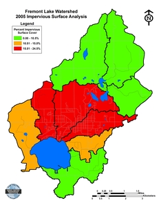
Fremont Lake 2005 ISAT
Impervious Surface Analysis
Click Image for Larger Map
TOP
Project Home Page
Fremont Lake Watershed Location
Fremont Lake Watershed History
Fremont Lake Watershed Land Use/Cover
Fremont Lake Watershed Monitoring
Fremont Lake Watershed Modeling
Conclusion & Recommendations
Contact Us

