Sustainable Futures for the Muskegon River Watershed - Project Specifications and Procedures
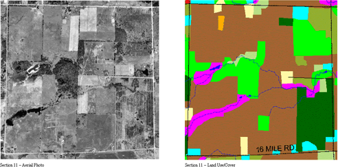
1998/1999 Land Cover/Use Update for the Muskegon River Watershed
Work performed by:
The Center for Remote Sensing and Geographic Information Science, Michigan State University
In cooperation with:
The Annis Water Resources Institute (AWRI), Grand Valley State University
Data Source Information
Methods Used
Accuracy Assessments
Quality Assurance / Quality Control
Data Source Information:
Imagery used for the interpretation:
- 1998/1999 National Aerial Photography Program (NAPP) U.S.G.S
- Nominal Scale: 1:40,000
- Film: Color Infrared
- Date: April 1998 and April 1999
- Scanned Resolution: 1 meter x 1-meter pixel resolution (1016 dots per inch)
Imagery ground control extracted from:
- Michigan Framework (The Michigan Center for Geographic Information)
- Scale: 1:100,000
Digital Elevation Model used in the ortho-rectification process:
- U.S. Geological Survey DEM
- Scale: 1:24,000
Update 1978 Land Cover / Use Polygons:
- MIRIS 1978
- Scale: 1:24,000
Methods Used:
- Aerial photo scanning:
All images were scanned on a transmissive scanner at 1016 dots per inch to achieve a pixel resolution of 1 meter x 1 meter. This means that any object on the ground that is 1 meter x 1 meter can be resolved on the scanned imagery. - Ortho-rectification process:
All images were ortho-rectified and mosaiced using the Orthobase component in Erdas Imagine, version 8.4 or 8.5. Total image unit-weight RMSE was less than 5. - Corrections made to 1978 MIRIS update:
The original 1978 MIRIS Land Cover / Use polygons were corrected for gross errors by comparing them to the original 1978 photography held by the Michigan Department of Natural Resources. Any changes to polygons were made in ArcInfo version 7.2.1. The minimum mapping unit (MMU) was 2.5 acres. The minimum mapping distance (MMD) was 100 feet (30.48 meters). - 1998/1999 Update process:
The improved 1978 polygons were overlaid on top of the 1998/1999 imagery and any changes in the landscape were made by altering the polygons in ArcInfo version 7.2.1 or 8.1 and ArcView version 3.1 or 3.2. Once again, the minimum mapping unit (MMU) was 2.5 acres. The minimum mapping distance (MMD) was 100 feet (30.48 meters).
Accuracy Assessments
- Image Mosaic Spatial Accuracy:
The error for all mosaics falls between 10.59 meters and 17.17 meters or a scale of 1:21,000 and 1:33,800 as set by the Federal Geographic Data Committee. The average error across all township mosaics is 13.71 meters or a scale of 1:26,993. - Polygon Horizontal Spatial Accuracy:
Original polygons are at a scale of 1:24,000. This equates to a spatial accuracy of ¿ 12.19 meters. An additional assessment using GPS is being done by AWRI. - Polygon Thematic Accuracy:
As a result of field checks, redundant interpretation, and correction of errors in the original 1978 polygons the project goal is to have 95% or better accuracy. In other words, more than 95% of all polygons are correctly classified.
Quality Assurance / Quality Control:
- Polygons:
All 1998/1999 Land Cover / Use polygons were interpreted by two separate interpreters to assure consistency and accuracy. In addition, 5% of all polygons were field verified. These included unknown polygons, ambiguous polygons and random polygons. Field checking was performed by the Center for Remote Sensing and GIS, Michigan State University and by the Annis Water Resources Institute, Grand Valley State University.