White River Watershed Project - Study Area
Project Home Page | Study Area | Water Quality | Project Information | Project Partners | Additional Resources
Watershed Tidbits
- In early French maps the White River is shown as Ouabisipi ou R. Blanche. The Ottawa's name for the river was waba-sippi (meaning White River). Suspended clay particles from marl deposits cause the river to appear "whitish".
- In 1945, the Huron National Forest and the Manistee National Forest were administratively combined into the Huron-Manistee National Forest, a forest "united by rivers." The Huron-Manistee National Forest makes up 23% of the watershed.
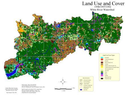
- A little over half of the watershed is forested (about 200,000 acres).
- In 1975 the White River became the fifth state river designated under the Natural Rivers Act.
- The watershed contains a number of rare and endangered habitats including coastal plain marshes, bogs, dry sand prairies, barrens, wet meadows, and mesic prairies.